

Author Peter Edwards.
Although out of date – it was published in 1993 – it is a useful summary of the documents that are available which need to be examined to complete a history of a rural parish.
Author Peter Edwards.
Although out of date – it was published in 1993 – it is a useful summary of the documents that are available which need to be examined to complete a history of a rural parish.
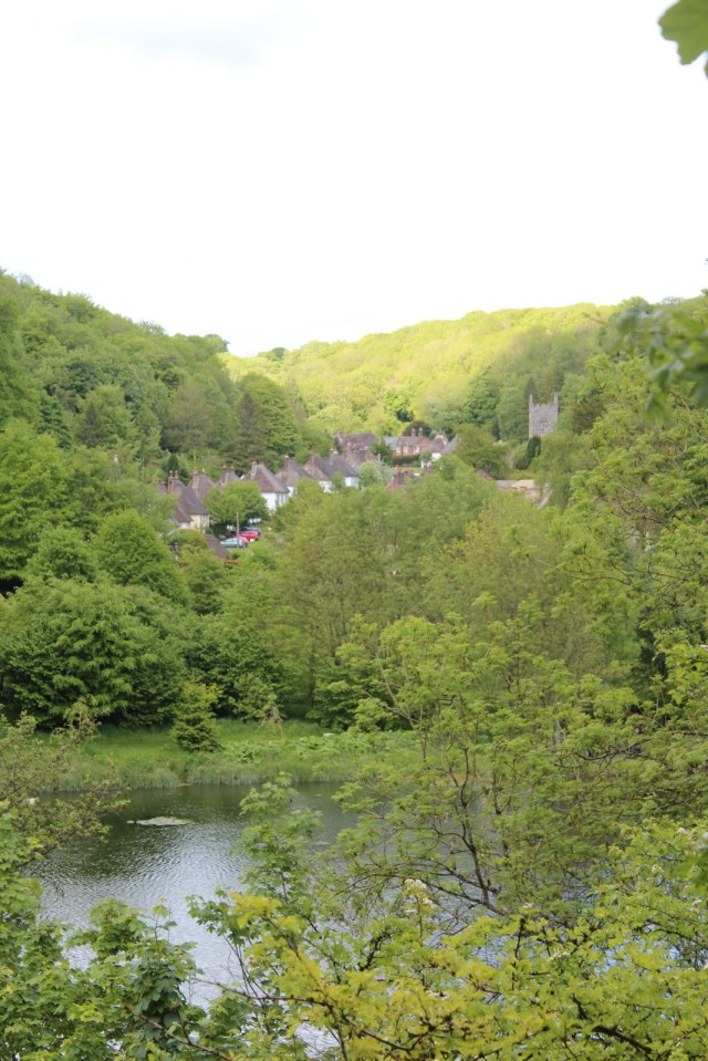
A lovely view of The Street of Milton Abbas nestled in its valley. Unfortunately this is not how Capability Brown intended it. It was meant to be much more open with a clear view from this spot across the lake up the street. This spot would be one of the places where Lord Milton would stop the carriage with his guests to show them how he had housed his estate workers.
Still after 250 years of tree growth, death and regrowth this is the best we can do. Note Capability Brown wanted his lake to be seen and with clear views across it in every direction.

This book is out of date, it was published in 1984, the days before the internet. I borrowed it from Libraries West. It is out of print but can be bought for £0.01 plus p&p.
In spite of this it does help with all the information that is needed to compile a history of Milton Abbas.
I am going through it methodically to check that the Milton Abbas History Group is doing all the right things.
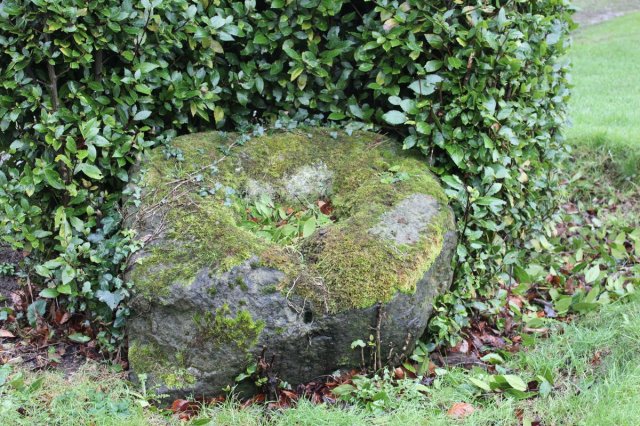
The only remaining evidence of the Anglo-Saxons at Milton Abbas is this stump of a market cross. It has no display board pointing out its importance to the history of the community. It is sad to see such a lack of interest in a once thriving town.
 There is precious little evidence that Milton Abbas was occupied in Anglo-Saxon times, but this is one fragment that is definitely of this period. It was in the Abbey with the other stone fragments. I’m not sure where it is now, with the various moves during the refurbishments going on – I”ll look for it.
It seems rather narrow to be part of the shaft of the market cross.
The following is from Corpus of Anglo-Saxon Stone Sculpture South West England, Rosemary Cramp, British Academy, 2006
Part of rounded shaft
PRESENT LOCATION In the abbey church, displayed in a metal frame at west end of south transept when visited in 1992, but not there in 2004
EVIDENCE FOR DISCOVERY None; possibly found during excavations at the west end of the church in 1865 (Roberts 1880, 88-9; (——) 1903, Ixv)
STONE TYPE Yellowish grey (5Y 8/1), dominantly medium-grained, shelly, matrix-supported oolite, with the ooliths weathering out to give an ‘aero-chocolate’ texture; a few stand proud. Shell fragments up to 5 mm across, but no obvious alignment. Bath stone, Chalfield Oolite Formation, Great Oolite Group, Middle Jurassic PRESENT CONDITION Dressed off flat on three sides and broken at each end
DESCRIPTION Part of a rounded shaft with loose median-incised interlace.
DISCUSSION This was originally a rounded shaft like Yetminster (Ills. 153-7). The interlace type does not conform to any geometric type, but this is common in this region: the particularly tangled form here may be compared with Whitcombe (111. 142).
This is an important site with a large land-holding (Hall 2000, fig. 74). Milton Abbey was traditionally founded by King Athelstan (925-40), and was certainly a religious site by 964: see Anglo-Saxon Chronicle MS A, that tells of substitution of monks for priests (Whitelock 1979, 226).
DATE Tenth century(?)
REFERENCES R.C.H.M.(E.) 1970d, xlviii, pi. 12; R.CH.M.(E.) 1970e, 189 (5); Newman and Pevsner 1972, 288
We already have the list of 136 names in Milton Abbas because they were printed in a book edited by Edward Alexander Fry, Dorset Records Vol 12, available for free download at http://www.archive.org, but now images of the original two pages for Milton Abbas are available here
Note that the Arnold family figure prominently in the list of names, but there is no Tregonwell, I don’t know why.
Our next job is to compare these names with those given on the 1652 Byles map.
This period also ties in with the Churchwardens Books that are being transcribed.
A big thank you to our transcribers who are adding to the history of Milton Abbas. And a big thank you to one of our members who has allowed us access to these nearly 250 years old stories.
The Overseers of the Poor Books are a vital source of information for us. They give the names of those people receiving relief, and how much, and the names of the people who were paying rates and how much they paid.
It is helping us with the family histories of those who were living here in the 18th century.
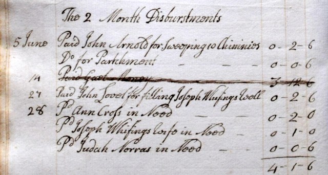
The language and spelling are also of historical interest, and give an insight into the education, who could read and write, who was handling large sums of money, and who were the given responsibility for seeing to the needs of the poor.
We have a semi-permanent display in the south aisle of St James’ Church, Milton Abbas. Alongside the display is a Visitors Book so that those interested in the history of Milton Abbas or having ancestors from here can leave there contact details.
We have made some useful contacts this way.
 This morning Josie Hagan from Bournemouth University carried out a magnetometry survey around St Catherine’s Chapel. We look forward to seeing the results.
The earthworks surrounding St Catherine’s Chapel are a mystery, and several legends have built up around them. One of these is that it was an encampment of King Athelstan and his army before they went to fight the most important battle in England’s history – the Battle of Brunanburh in 937 where he defeated the combined Danish, Scottish and Strathclyde forces.
Or it might be a yard surrounding the chapel.
This survey may shed some light on what is under the ground.

