
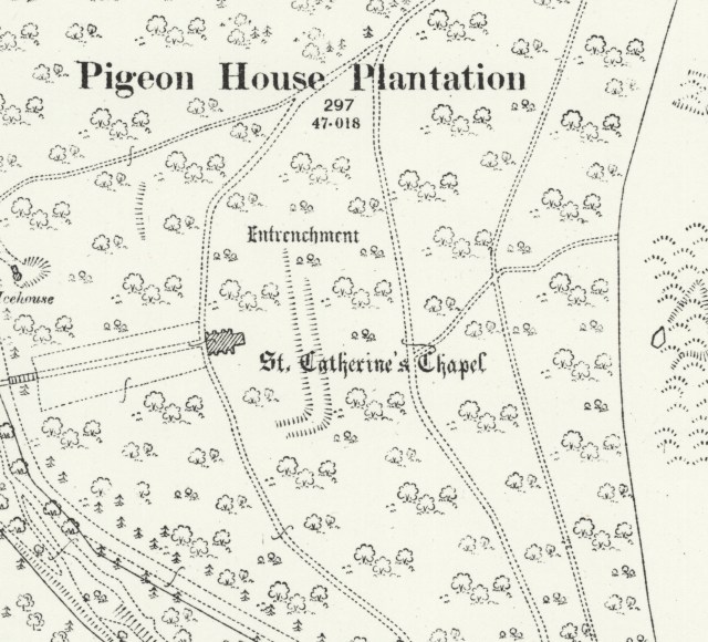
 Surrounding St Catherine’s Chapel is an earthwork embankment marked on the Ordnance Survey 25 inch map which was surveyed in the 1880’s and published in 1902.
19th century antiquarians thought that this was part of the legend of King Athelstan’s foundation of the Abbey of Middleton. The story from William of Malmesbury being that this location was the site of Athelstan’s army before they set out for the seminal battle of Brunanburgh.
These earthworks are still visible in the woods.
Only archaeology could determine the date of construction. Wouldn’t it be great if they were from the Anglo-Saxon period? Or is that just wishful thinking?
